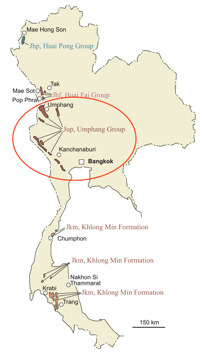
Umphang Gr
Type Locality and Naming
Type locality: Along a track 3 km north of Klo Tho village of Umphang district to Pu Khloe Khi village in Myanmar. Meesook and Grant-Mackie (1996) named the Umphang Group and subdivided it into 4 formations in ascending order: Klo Tho Fm, Ta Sue Kho Fm, Pu Khloe Khi Fm, and Lu Kloc Tu Fm.
Synonym: กลุ่มหินอุ้มผาง
Lithology and Thickness
Limestone, sandy and brecciated; sandstone; and shale, grey and red, thick-bedded to massive; limestone, limestone conglomerate and shale, grey to dark grey and red, well bedded. Thickness: 430 m.
Relationships and Distribution
Lower contact
The bottom of the group has not been seen, although it is presumed to rest unconformably on the older rocks in the area.
Upper contact
The top is unknown but the youngest exposed strata are well-bedded sandstones. It is likely to lie unconformably beneath Tertiary strata since no Cretaceous rocks are known in the region. Regionally, the next younger unit is the Mae Tun coalfield coal unit (Late Eocene-Early Oligocene), followed by the Mae Ramat Fm (Mae Sot Gr).
Regional extent
Umphang basin, Tak Province. Marine Jurassic strata are well exposed in Umphang District in Tak Province, 164 km south of Mae Sot. The strata crop out widely west of Umphang town in the areas of Ban Klo Tho and Ban Pa La Tha and local exposures are scattered throughout the area.
Correlation: Hua Fai Gr, Huai Pong Gr. The Umphang Gr is distinguished from the Huai Fai Gr of the Mae Sot district which lacks sandstones and in which limestone and marl or mud- stone are intimately interbedded.
GeoJSON
Fossils
Age
Depositional setting
Additional Information
Lexicon of Stratigraphic Names of Thailand of 2013.
